Open Data on a Continental Scale
Digital Earth Australia, Geoscience Australia
Since the acquisition of data about the earth began decades ago as the first satellites capable of making detailed observations were launched, mankind has gathered 1000s of petabytes of data. Data that has the potential in providing insights/information and detailed accounts of the changes on Earth, from water resources and coastal change, to human habitation and agricultural development.
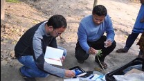
Across the vast landmass of one of earth's largest countries, Geoscience Australia is home to one of many large caches of this kind of data, providing arguably one of the most detailed accounts of an entire continent in the world. In recent years, they've brought over 30 years of data together, in an organised manner and coupled it with supercomputing infrastructure to make it more accessible and ready for analysis by researchers and government agencies across the nation. Future plans include expanding the use to industry and the general public.
Five years after the inception of Australian Geoscience Data Cube, a pilot project which paved the way for this kind of capability, the Australian Government has funded Digital Earth Australia, the culmination of this work. DEA will provide an account of every 10 metre squared of the Australian continent, updating every 5 days. DEA is intended to provide a platform to easily access and use this data and the tools to get the most out of it. Based on the Open Data Cube codebase, it also provides an example of how to develop and manage this kind of resource, while Open Data Cube's open source nature means the world is free to follow their example.